Lineriders crews submit a sketch for every line-locating job. There are different methodologies to capture the data for a sketch. Unmanned Aerial Vehicles (UAVs) are the primary choice for most locating crews. However, adverse weather conditions, simultaneous aircraft operations (helicopters), and proximity to airports or Built-Up Areas (BUAs) will factor into deciding whether to use a drone or not. Circumstantially, crews may not be able to safely operate UAVs for the purpose of aerial imaging.
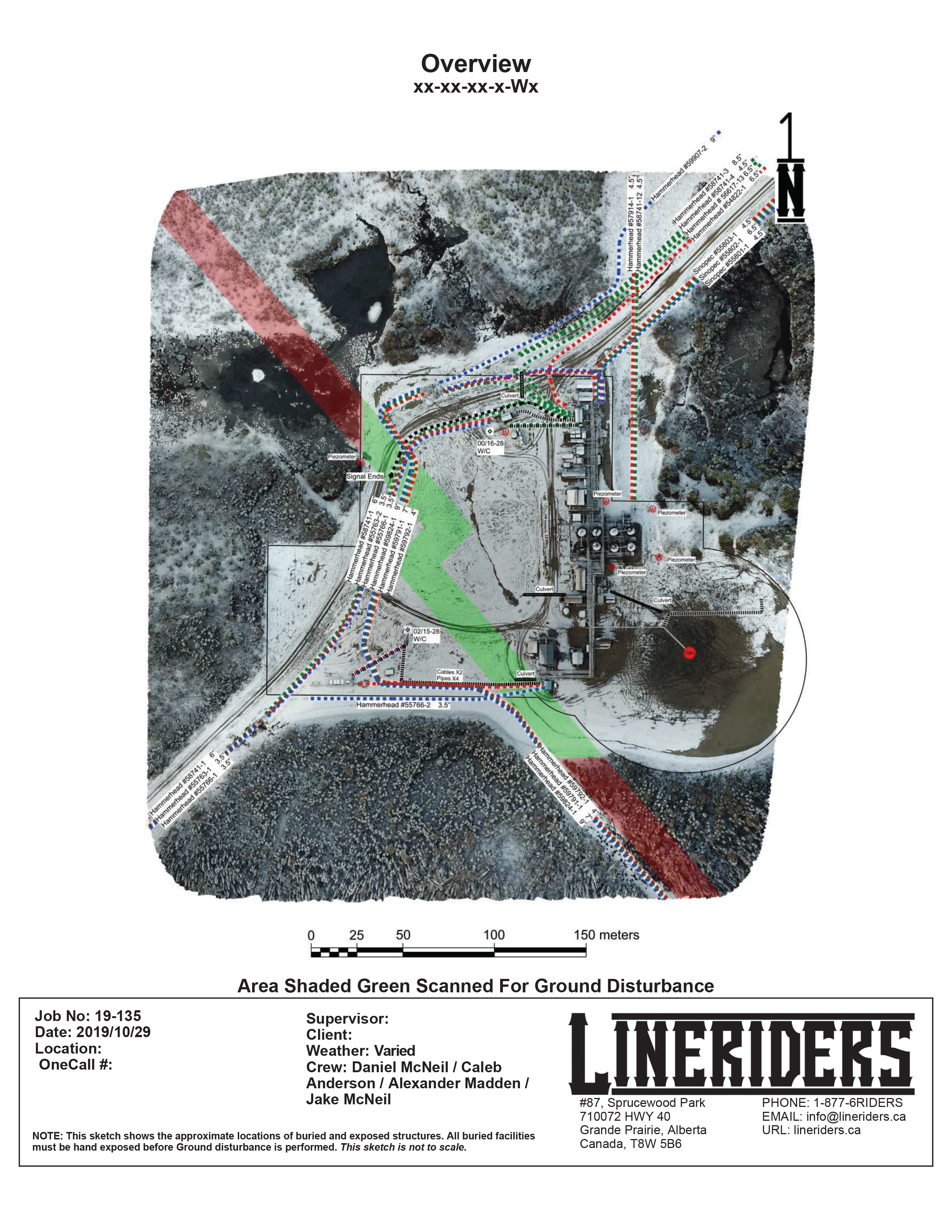
Drones remain the best choice for accurate, cost-effective, scale cartography. We create easy-to-interpret data by overlaying pipelines or cable locations onto a current aerial photograph of the site. These sketches can be done to scale, thus creating an accurate representation of the project. Crews aim to use drones whenever possible.
Regulations
Lineriders are licensed to operate UAVs in Canada and the United States. We take pride in abiding by all rules laid out by Transport Canada and the Federal Aviation Administration. Many people ignore UAV laws, but we take them very seriously. Sometimes, these rules pose obstacles when gathering data for a large project.
For larger projects, the drone needs to be at an extreme height to capture the entire site in one image. In order to adhere to government regulatory agencies, we are required to do one of three things. The first option is to cease all activities completely. For obvious reasons, this is not a consideration. Our second legal choice would be to file a flight plan with the nearest airport. This requires constant communication and is time-consuming. The third option is to take an orthographic image of the site. We can fly the drone at a lower height to achieve this. We utilize this method when possible.
Orthographic Images
An orthographic image is a series of images taken from a set height that covers a defined area. This allows the operator to work within the height limits of the FAA and Transport Canada. One orthographic image can be equal to hundreds or thousands of images. A software program assembles these images together and creates a composite image. The photo produced is highly detailed and represents a large amount of data. The final image is truly “top-down”, without any stretching or distorting of buildings or objects.
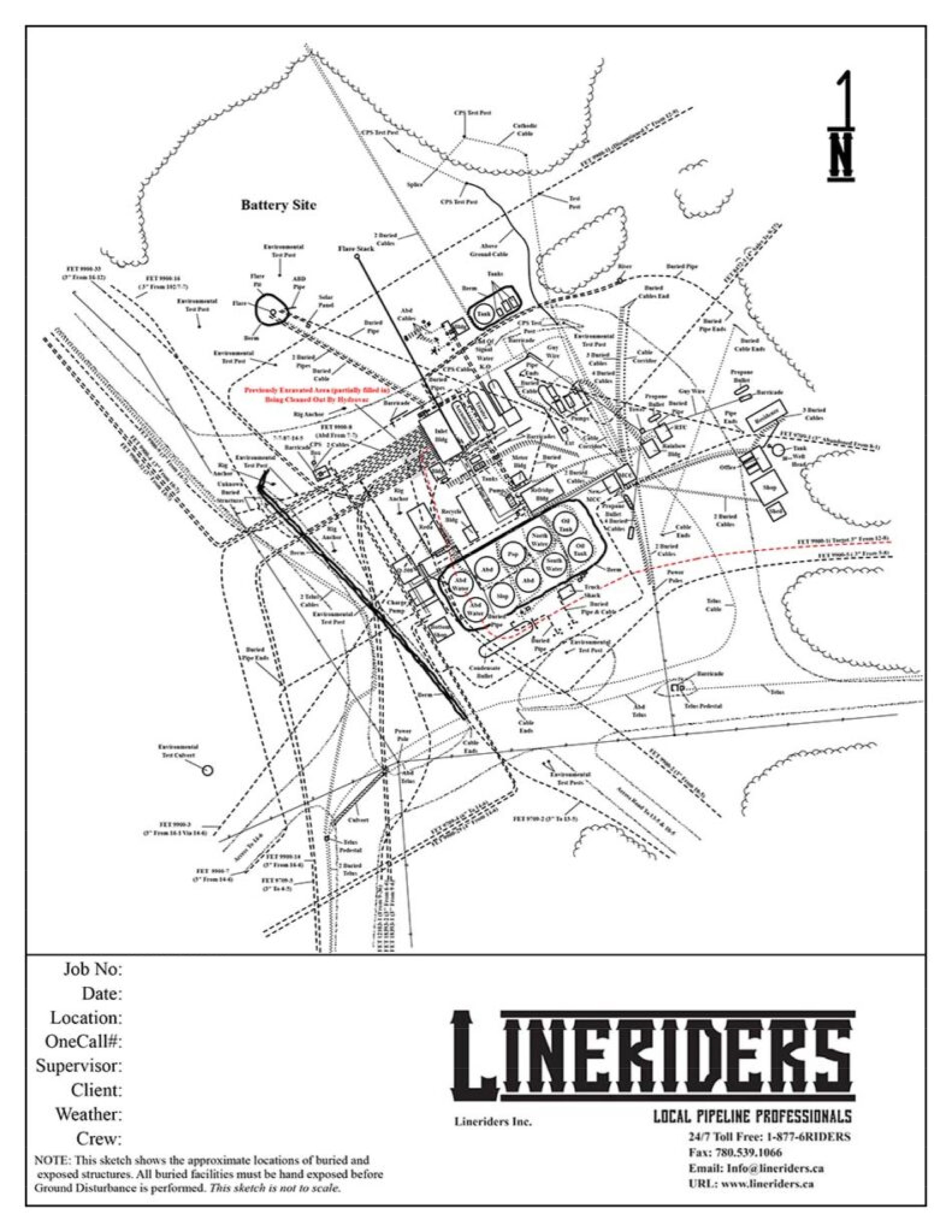
Hand Sketches
Depending on the circumstances, a hand sketch may be the only option available. Naturally, learning how to complete a detailed hand sketch without the use of a drone is very important. Lineriders creates digital sketches to represent all buried facilities. These sketches are not to scale.
Regardless of the obstacles on a project, Lineriders will deliver beautiful, easy-to-interpret, and accurate sketches.
Click image to enlarge
Click image to enlarge